• Skip to primary navigation
  • Skip to main content
  • Skip to primary sidebar

A brit in Brazil

  • Newsletters
    • Steve’s Newsletter 1 (2005)
    • Steve’s Newsletter 2 (2005)
    • Steve’s Newsletter 3 (2005)
    • Steve’s Newsletter 4 (2006)
    • Steve’s Newsletter 5 (2006)
    • Steve’s Newsletter 6 (2006)
    • Steve’s Newsletter 7 (2007)
  • Trips
    • A Brazilian Beach in Winter – Trancoso
    • Chile (part 1)
      • Chile: Northwards to San Pedro de AtacamaChile: caminho de volta à Santiago
      • Chile: Santa Cruz to PuconDe Santa Cruz a Pucón
      • Chile: Puerto Varas and ValdiviaPuerto Varas e Valdívia
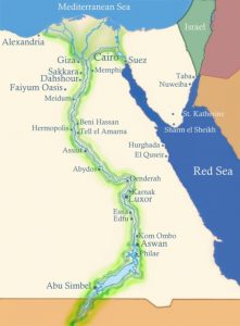
    • Viagem ao Egito – Introdução
      • De Assuã a Abu Simbel no comboio
  • Moving to Brazil
  • Contact Us

Holidays

Must see places in Brazil

6 December 2009 by Steve 1 Comment

I’m often asked by friends and students “What do British people think of when they think of Brazil?”.  I have to say beautiful beaches and women, carnival, the amazon rain-forest and crime.
Dealing with the last first, there is undoubtedly serious crime in Brazil, particularly in the big cities.  However, and I hope it stays this way, I haven’t personally had experienced this.  In fact, I’ve been told several stories about people going to the UK and having things stolen that weren’t stolen in Brazil.  I think with some common sense and staying away from certain neighbourhoods, then there isn’t a huge amount to worry about.

Devil’s Throat, Foz de Iguaçu

With regards my other answers, they are true, but there is so much more that Brazil has to offer.  For example, the beaches aren’t just Copacabana, Ipanema and Leblon in Rio de Janeiro.  Brazil has about 2800km of beaches and, in my experience, most of them are spectacular and many exceed the beaches I’ve seen in other parts of the world.
So, apart from the beaches, where would I suggest visiting.
Foz de Iguaçu/Itaipu
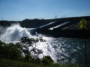
Itaipu Dam with spillway open

Foz de Iguaçu (or Iguazu in Argentina) should, in my opinion, be considered as one of the natural 7 wonders of the world, however, Itaipu Dam is considered by American Engineers to be one of the engineering world.  Where else, within a few kilometres travel, can you see TWO such sites.
Foz de Iguaçu is a huge waterfall which is over 270m long, consists of upto 275 individual falls with a drop of approximately 82m.  It is on the Iguaçu river which delimits the border between Brazil and Argentina.  The Devils throat is quite spectacular.  On the Argentinian side you can get almost to the very top of the falls, whilst from the Brazilian side you can take a boat and travel to the base of the falls.
The Itaipu Dam was ‘jointly’ built by the Paraguayan and Brazilian governments but was mostly funded and constructed by Brazil.  It dams the Paraná River just above where it meets the Iguaçu River.  The convolution of the 2 rivers marks the border between Argentina, Paraguay and Brazil, which is unique in the world as well!
The dam generates 20% of Brazil’s total electrical needs and all of Paraguay’s.  It is possible to take a tour of the dam which includes the control centre, a drive over the top and base of the dam.  If you are lucky, like we were. you can see excess water being released down the spillway, but this is only about 10% of the days.
For more pictures of both these sites, please see our photos.
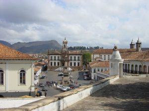
Ouro Preto central square

Colonial towns such as Ouro Preto and Tiradentes
These are historic cities founded by the Portuguese colonizers which are in the state of Minas Gerais (where we live). They give a glimpse into early life of Brazil.  In my opinion, many of these towns and cities are quite similar but a visit to one or more is a must.
Ouro Preto (black gold) is today on Unesco’s list of world heritage sites.  It was the focal point of Brazil’s 18th century gold rush and gold can still be seen today decorating many of the numerous historic catholic  churches.  It is set in a valley and was once the state’s capital until Belo Horizonte was built.
Rio de Janeiro
Most people know of Rio so this is very brief.  It is really beautiful city and has many attractions such as the harbour, the lagoon, Sugar Loaf, beaches such as Copacabana and Ipanema and of course Corcovada (where the famous Christ the Redeemer is to be found).  There are many many other attractions, great restaurants.  I currently rate Rio as my second favourite city in the world.
The above are all places we have visited.  The ones below come highly recommended and are on our list of places to visit.
Fernando do Noronha
Fernando do Noronha is an island archipeligo about 350km off the northeastern coast of Brazil.  In many ways it is the Atlantic’s Galapagos with the upwelling of water drawing much marine life.  However, it doesn’t have as large a diversity of terrestrial animals as does the Galapagos Islands.  It is regarded as the best diving in Brazil, a fact I have yet to test.
Bonito
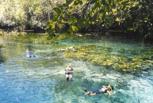
Bonito is famous for its crystal clear rivers that are a result of a natural filtration.  It is being preserved to keep its pristine natural beauty.  Activities include walking/treking and swimming/snorkeling/diving in the rivers and caves to be found in the area.
Amazonia
The amazon is a river basin surrounded by rainforest and is located in the countries of Brazil, Peru, Colombia, Venezuela, Ecuador, Bolivia, Guyana, Surinam and French Guiana.  The region and diversity is so varied that I’ll mention only a few things that I’d like to see and do.  In no particular order, see the confluence of the Rio Negro and Amazon river, swim with the river dolphins and experience the rainforest and jungle.
The Pantanal
The Pantanal is the world’s largest wetland covering an area of around 140,000 sq km.   It is renowned for its bio-diversity.  It is also easier to spot the wildlife in the Pantanal than in the Amazon as there are less hiding places.  As Bonito, it is predominantly located in the Brazilian state of Mato Grosso do Sul.  There are thousands of different vertebrate species to be found there.

Lençoís Maranhenses

Lençoís Maranhenses
This is a region covering 1000 sq km of in the northeastern Brazilian state of Maranhão.  Despite heavy rainfall, it is a region largely devoid of vegetation with many discreet sand dunes and lakes.
As and when we visit these places, we’ll write more.
So you see Brazil isn’t just Rio, beautiful people and crime.  It has far more to offer.
Filed Under: Brazil, Holidays Tagged With: Beach, Brazil

Viagem ao Egito – Introdução

11 November 2009 by Eneida Leave a Comment

Este é um relato da nossa viagem ao Egito, que foi feita no período de 29 de dezembro de 2008 a 10 de janeiro de 2009.
O Steve já tinha estado algumas vezes naquela região especialmente para mergulhar, já que o Mar Vermelho é considerado um dos melhores lugares do mundo para mergulho. Como eu também queria ter esse mergulho no meu (brevíssimo) currículo de mergulhadora, resolvemos que nosso roteiro começaria com uma estada no Mar Vermelho, mais especificamente em Hurghada.
O restante do roteiro foi determinado em razão da conveniência de transporte a partir de Hurghada. Dessa forma, resolvemos começar o cruzeiro pelo Nilo em Luxor, por estar mais próximo. Fizemos o percurso Hurghada – Luxor de carro, em uma viagem de cerca de 3 horas numa estrada cercada de deserto por todos os lados.
O nosso passeio pelo Nilo começou em Luxor e terminou em Aswan. Outro lugar que eu sabia que tinha de ir (e fui e recomendo) é Abu Simbel, a cidade mais ao sul do Egito, já perto do Sudão, onde se encontra o  maravilhoso Templo de Ramsés II. Fizemos um “bate-volta” a Abu Simbel a partir de Aswan. De lá, voamos para o Cairo, onde passamos os dois últimos dias da viagem.
Em grupo ou independente?

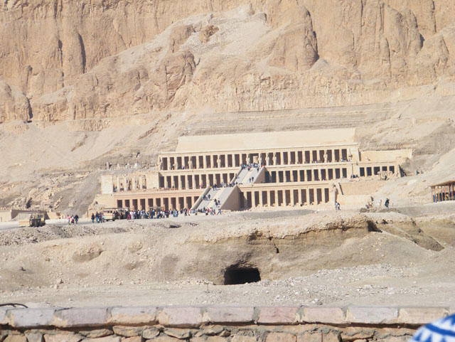
Templo de Hatshepsut – Luxor

Em princípio, sempre optamos por formas mais independentes e menos empacotadas de fazer turismo, mas no Egito achamos melhor revermos este conceito. Não que seja impossível conhecer as atrações todas sem fazer parte de um grupo, mas pelo que tinha lido, isso requer um certo desprendimento e capacidade de abstração que eu e o Steve não temos. Ou então muito planejamento. Achei interessante este depoimento do Ricardo Freire (guru para assuntos de viagem):
“Como ninguém precisa ver as pirâmides ou entrar na tumba de Tutancâmon mais do que uma vez em cada encarnação, o turista vira um cachorrinho num campo minado de pulgas. E o pior é que, além de coçarem, as pulgas querem pagamento — baksheesh — por toda sorte de desserviços prestados, tipo por exemplo te chamar num cantinho da tumba de um Ramsés qualquer e informar: Sarcofagus! Very old!” (Postais por escrito, 1998)
Parece exagero, mas não é. O assédio ao turista é tamanho e tão frequente que é duro de aguentar. Então, para evitar as pulgas, resolvemos optar por um dos cruzeiros no Nilo e visitar os principais pontos turísticos da região acompanhados de um guia. Para nós, achamos que foi uma boa escolha e mesmo quase um ano depois acho que não faria diferente.
Cruzeiro no Nilo?

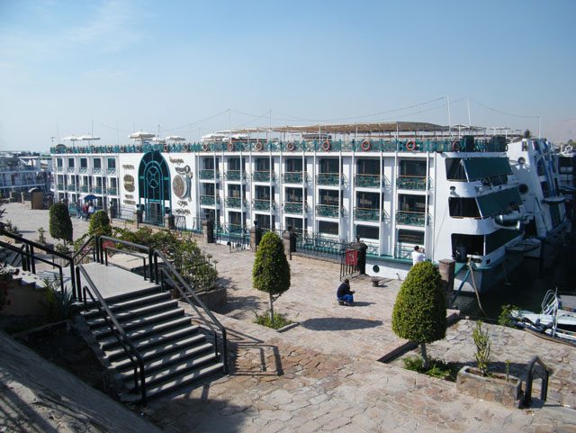
moon goddess1
Nosso barco: Moon Goddess

Existem opções para todos os bolsos e gostos, mas o percurso é o mesmo. Ou você vai de Luxor à Aswan ou ao contrário, em cruzeiros de 3, 4 ou 7 noites. O navio será seu hotel, e também onde são feitas todas as refeições. Para cada grupo de 10-15 pessoas há um guia – seu próprio “egiptólogo” – que acompanha o grupo a todas as atrações. Não há muita variação em termos de lugares visitados, todos seguem o mesmo roteiro e visitam as atrações mais óbvias: saindo de Luxor, parada em Edfu, Kom Ombo e final em Aswan. Todos os cruzeiros oferecem também “programação” noturna que inclui jantar com o comandante, festa à fantasia (mas não é obrigatório comparecer!) e shows de dança do ventre e folclore núbio.
Escolhemos este navio, o Sonesta Moon Goddess, que nos pareceu confortável, com alimentação de qualidade razoável, um preço que cabia no nosso orçamento e a data de saída de Luxor era exatamente a que precisávamos. Gostamos, o navio não decepcionou em nada (aliás, a surpresa boa foi que a comida foi bem melhor do que esperávamos). O guia era um estudante do Cairo que fazia este trabalho nos meses de férias. É claro que ele nos levou a lojinhas de papiros e de alabastro que não estavam propriamente no programa, mas que renderia a ele algumas comissões. Tudo bem, faz parte.
Quando ir, o que levar, etc.

camelo
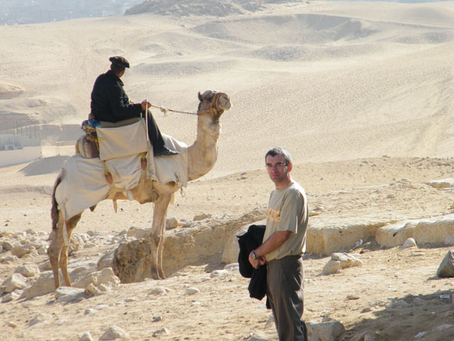
Guarda das pirâmides de Gizé

Fomos em janeiro porque é o período que tiramos férias e estaríamos na Inglaterra para o Natal. A temperatura estava super agradável, fazia até um friozinho de manhã. Acho que não passou dos 30 graus em nenhum dia. Parece que até março ou abril o calor ainda é suportável, mas nos meses do verão (deles) deve ser difícil encarar os passeios sob o sol de 40 – 45 graus. Sempre que voltávamos para o barco, nos ofereciam toalhas úmidas para passar no rosto e um suco de limão quente, que – dizem – é bom para matar a sede até que seu organismo volte à temperatura normal.
O que não pode faltar na mala: sapato (fechado) confortável. Os templos são todos na areia (afinal, estamos no deserto), então seus pés ficam bem sujinhos se estiver de sandália. Outro item importante: um xale (pode ser comprado lá, uma das muitas coisas que te oferecem são xales lindos), pois mesmo no verão os lugares com ar condicionado são frios. E não se esqueça de um chapéu com abas.
Também é bom ter sempre em mãos notas de valor pequeno para dar de gorjeta: o famoso baksheesh que todo mundo vai te pedir. E um livrinho básico relacionado à história do Egito ou às descobertas dos arqueólogos, ou mesmo Agatha Christie (Morte no Nilo) também vai muito bem!
Próximos capítulos
Muitas fotos e relatos mais detalhado sobre os lugares que visitamos. Até!

Filed Under: Holidays, Portugues Tagged With: Egito

London’s Public Transport Transporte em Londres: uma introdução

30 August 2009 by Steve Leave a Comment

One of the questions I’m often asked is “What is the metro like in London?”

First, there are several public transport systems in London, most of which are now managed by the city council. There is the London Underground, which Londoners call the “The Tube”, and it has 12 separate lines. The tube network is mainly in the north half of the city because of London’s geology. This system starts operating at around 5:30am and runs until about 12:30am seven days a week. The trains depart central London stations at about 2-3 minute intervals during peak times, and 7-8 minute intervals in off-peak times. Contrary to general opinion, much of the Tube is above ground, particularly away from the central zones. See the tube map.
There are also plenty of London buses, including the famous red double-deckers. Their routes extend across the whole of London and operate for similar hours to the tube. However, there are also night buses. These night buses run along similar routes to some of the day buses but have a reduced frequency. You can get on a night bus from about midnight in central London and take it to your neighbourhood in the suburbs.
Additionally, there are also river buses in central London, but they aren’t generally used by Londoners.
Finally, and definitely not least importantly, there is the National Rail network or over-ground train system. This is operated by many different companies and the trains depart from many central London terminus stations like Waterloo, King’s Cross, St Pancreas, Victoria and Paddington.
The southern half of London is mainly served by this overland network rather than the Tube. Therefore, if you look at the famous Tube map, don’t be fooled into thinking this is the complete ‘train’ network. There are in fact, probably, twice as many stations with the other 50% appearing on the ‘London Connections’ map.
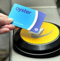
To use this network, you can buy single tickets to go from place to place, or you can buy daily, weekly or monthly tickets or even an oyster card from any of the stations or other points of sale such as newsagents. The cost of travel depends on how far you travel. The entire network is divided into 6 principal zones. These zones are arranged as concentric ‘circles’ around the centre of London. All you need to do is buy a ticket for the zones you want to travel to and from (and any zones you pass through en-route).

To navigate on the Tube is very easy. Each line is colour coded. On the map, the stations where you can change from one line to another are shown as a circle, the non-interchange stations are shown as a ‘tag’. The direction of travel is shown on the front of each train and on signs on each platform. Additionally, it is important to know your north, south, east and west despite the fact that the platforms are labelled as northbound, southbound, eastbound or westbound. To find your way round, you simple follow the colours of the lines/signs and have a general idea if you need to go north or south.
I hope this brief introduction of getting about in London is helpful.
For further information: Transport for London
Pictures: Wikipedia and Guardian.co.ukUma das perguntas que sempre me fazem é “Como é o metrô em Londres?”

Para começar, há vários sistemas de transporte público em Londres, a maioria deles gerenciada pela prefeitura da cidade. Há o famoso metrô “London Underground”, que os londrinos chamam de “The Tube”, com 12 linhas separadas. A rede do Tube está localizada principalmente na parte norte da cidade devido à geologia de Londres. O sistema começa a operar às 5:30 da manhã e funciona até aproximadamente 00:30, sete dias por semana. Os trens partem das estações centrais de Londres a cada 2 ou 3 minutos durante os horários de pico, e em intervalos de 7 a 8 minutos nos outros horários. Ao contrário do que muitos pensam, grande parte do Tube não é subterrânea, principalmente nas áreas afastadas do centro da cidade. Veja o mapa do metrô.

Londres conta também com um sistema de ônibus: entre eles, os famosos double-deckers (ônibus de dois andares) vermelhos. As rotas se estendem por toda a cidade, e o horário de funcionamento é semelhante ao do metrô. A diferença é que existem os ônibus noturnos. Os ônibus noturnos mantêm rotas similares às de alguns ônibus diurnos, mas a frequência é menor. É possível pegar um ônibus noturno no centro de Londres a partir de meia-noite para ir aos bairros nos subúrbios.
Existem também ônibus-barco no centro de Londres, mas eles quase não são usados pelos londrinos.
E por último, mas com certeza não menos importante, há a Rede Nacional de ferrovias ou sistema de trens de superfície. Esses trens são operados por diferentes empresas e partem dos diversos terminais ferroviários de Londres como Waterloo, King’s Cross, St. Pancreas, Victoria e Paddington. A parte de Londres situada ao sul é servida principalmente por este sistema de trens de superfície e não pelo Tube. Sendo assim, não pense que a rede de “trens” que você vê no famoso mapa do metrô está completa. Na verdade, deve haver pelo menos o dobro de estações e essas outras 50% aparecem no mapa de conexões chamado “London Connections”.


Para usar todos esses tipos de transporte, você pode adquirir passagens únicas para ir de um lugar ao outro, ou pode adquirir passes diários, semanais ou mensais, ou o seu Oyster card. Eles podem ser comprados em qualquer estação ou outros pontos de venda como bancas de revistas. O custo da viagem depende da distância. A rede completa é divida em 6 zonas principais. Essas zonas são “círculos” concêntricos ao redor do centro de Londres. Você só precisa adquirir o bilhete válido para as zonas em que você quer se deslocar (e aquelas que estiverem no caminho).
É muito fácil usar o Tube. Cada linha tem uma cor diferente. No mapa, as estações em que você pode trocar de uma linha para outra são mostradas com um círculo, e as estações em que a troca não é possível não têm o círculo. O sentido da viagem é mostrado na frente de cada trem, e também aparece na plataforma. É importante saber em que sentido você quer ir (norte, sul, leste ou oeste), mas há indicação nas plataformas juntamente com os nomes das estações. Você verá “northbound” (para o norte), “southbound” (para o sul) “eastbound” (para o leste) ou “westbound” (para o oeste). Para achar seu trem, você deve seguir a cor ou o nome da linha que deseja tomar e saber mais ou menos se quer ir para o norte ou sul, leste ou oeste.
Espero que essa breve introdução ao transporte em Londres seja útil.
Fotos: Wikipedia e Guardian.co.uk

Filed Under: Britain, English, Holidays, London, Londres, Portugues, Transporte Tagged With: Holiday, London, Londres, metrô, The Tube, transporte

A Brazilian Beach in Winter – Trancoso

23 July 2009 by Steve 2 Comments

What is a beach holiday during winter like in Brazil?  Following our 1 week’s trip to Trancoso in the state of Bahia, let me try to explain.

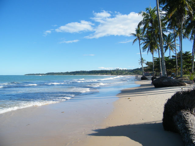
Praia dos Coqueiros looking towards Praia Rio Verde

Firstly, in the state of Bahia at least, the temperature is very very different to the British (oops nearly wrote English!) winter.  The temperatures were in the mid to high 20’s during the day and high teens at night much like our summer.  The only downside at this time of year is that it can rain and be a little windy.  It rained most days, but not for long and it was always possible to spend some time in the sun on the beach.
That is not all, there are something over 33,00 kilometres of beach in Brazil and a population of about 185 million so the beaches are not crowded especially in ‘winter’ holiday.  There are of course exceptions to this, but with a little searching it isn’t hard to find some space.
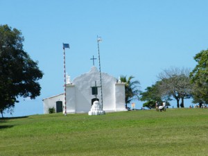
Trancoso church - the nearby city of Porto Seguro is where Europeans first landed in Brazil

However, the deserted sections of beach are lacking an important facility.  Here it is customary for bars/restaurants, or private individuals in the case of Rio de Janeiro for example, to layout chairs, tables and parasols for their customers.  There is usually a waiter just a ‘moço’ (boy) call away.
The beach also has its entrepreneurs who walk up and down between the bars selling their merchandise such as costume jewellery, suntan lotion, sunglasses.  In Rio you can find almost anything on the beach!
With regards Trancoso, it is a smallish community that was once described as a beach for ‘hippies’, more recently as a beach for chic hippies, and now as a beach for the chic.  In truth, I would say, as is often the case in Brazil, it is a mix of the poor and the rich.
To get to Trancoso, you either need to fly, as we did, or take a bus.  A flight from Belo Horizonte to Porto Seguro is about an hour long.  From Porto Seguro, it is an hour’s drive either by road (about 45 miles) or by ferry across the river ? from Porto Seguro to Arraial d’Ajuda and from their a drive of  about 25 miles.
The historic town is built around the ‘Quadrado’ with the church at the ocean facing end and shops/restaurants running down either side.  The shops mainly sell hand made things from the local artisans.  The restaurants serve mainly local Bahian/Brazilian food with lots of seafood.  We did however eat at an Australasian restaurant called ‘Masala’ where I had my first curry in Brazil.  It was surprisingly very good and well worth a visit.
<Craft shops on the side of the Quadrado, Trancoso
Craft shops on the side of the Quadrado, Trancoso

The accommodation is mainly ‘pousadas’.  They are a bit of a cross between a small hotel and a bed and breakfast.  The >one we stayed at was lovely and very close to the centre.  The other option is to stay at pousada on the beach which is a 10-15 minute gentle walk downhill.  If you feel like something more luxurious, there is a Club Med on the coast between Arraial d’Ajuda and Trancoso.
In summary, Trancoso is a lovely small town with huge amounts of character and a great place to spend a week relaxing on the beach or by a pool.  It isn’t a place I’d suggest if you want a lively place.  We are already considering a return visit!
If you want to see some more photos from our trip, you can see them here.
With regards the website, it is still very much underdevelopment, but I hope to have the design finalised fairly soon and then I’ll start adding content to the various sections.

Filed Under: Brazil, Holidays Tagged With: Beach, Holiday

  • « Go to Previous Page
  • Go to page 1
  • Go to page 2

Primary Sidebar

Recent Posts

  • Carnival in Brazil: It's time to samba
  • Watch this space
  • Our house in Tangará – second week
  • Tangará – our country house (under construction)
  • Brazil is calling You

Recent Comments

  • Steve on Our house in Tangará – second week
  • Jonny on Our house in Tangará – second week
  • Kristen Hardin on Chile: Santa Cruz to PuconDe Santa Cruz a Pucón
  • Eneida on Como ir de Heathrow ao centro de Londres
  • Joselia on Como ir de Heathrow ao centro de Londres

Archives

  • February 2014
  • May 2011
  • February 2011
  • July 2010
  • March 2010
  • January 2010
  • December 2009
  • November 2009
  • October 2009
  • September 2009
  • August 2009
  • July 2009
  • May 2007
  • September 2006
  • May 2006
  • February 2006
  • December 2005
  • October 2005
  • September 2005

Categories

  • Bairros
  • Brazil
  • Britain
  • Chile
  • Comida
  • Egito
  • English
  • Holidays
  • Hotel
  • Language
  • Lojas
  • London
  • Londres
  • Museus
  • National Holiday
  • News
  • Parques
  • Passeios
  • Portugues
  • Transporte
  • Uncategorised
  • Uncategorized

Meta

  • Log in
  • Entries feed
  • Comments feed
  • WordPress.org

Copyright © 2025 · Genesis Sample on Genesis Framework · WordPress · Log in